
File:Philippines location map.svg

Size of this PNG preview of this SVG file: 454 × 599 pixels. Other resolutions: 182 × 240 pixels | 364 × 480 pixels | 582 × 768 pixels | 776 × 1,024 pixels | 1,552 × 2,048 pixels | 1,871 × 2,468 pixels.
Original file (SVG file, nominally 1,871 × 2,468 pixels, file size: 2.18 MB)
Summary
| Description |
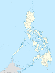
Deutsch: Positionskarte der Philippinen
Quadratische Plattkarte, N-S-Streckung 103 %. Geographische Begrenzung der Karte:
English: Location map of the Philippines
Equirectangular projection, N/S stretching 103 %. Geographic limits of the map:
|
| Date | |
| Source |
own work, using
|
| Author | NordNordWest |
| Other versions |
|


|
This map has been made or improved in the German Kartenwerkstatt (Map Lab). You can propose maps to improve as well.
|
Licensing
I, the copyright holder of this work, hereby publish it under the following licenses:

|
Permission is granted to copy, distribute and/or modify this document under the terms of the GNU Free Documentation License, Version 1.2 or any later version published by the Free Software Foundation; with no Invariant Sections, no Front-Cover Texts, and no Back-Cover Texts. A copy of the license is included in the section entitled GNU Free Documentation License. |
This file is licensed under the Creative Commons Attribution 3.0 Unported license.
- You are free:
- to share – to copy, distribute and transmit the work
- to remix – to adapt the work
- Under the following conditions:
- attribution – You must give appropriate credit, provide a link to the license, and indicate if changes were made. You may do so in any reasonable manner, but not in any way that suggests the licensor endorses you or your use.
You may select the license of your choice.
File history
Click on a date/time to view the file as it appeared at that time.
| Date/Time | Thumbnail | Dimensions | User | Comment | |
|---|---|---|---|---|---|
| current | 22:17, 25 Poutū-te-rangi 2016 | | 1,871 × 2,468 (2.18 MB) | Man77 | upd NIR, Davao |
| 11:46, 14 Whiringa-ā-nuku 2013 |  | 1,871 × 2,468 (2.2 MB) | Hariboneagle927 | fix | |
| 11:07, 14 Whiringa-ā-nuku 2013 |  | 1,871 × 2,468 (2.15 MB) | Hariboneagle927 | fix. Cagayan | |
| 10:58, 14 Whiringa-ā-nuku 2013 |  | 1,871 × 2,468 (2.15 MB) | Hariboneagle927 | Made some update and corrected some minor errors. | |
| 07:22, 9 Whiringa-ā-nuku 2013 |  | 1,871 × 2,468 (2.14 MB) | Hellerick | Regrouped for easier recoloring. | |
| 06:13, 7 Here-turi-kōkā 2013 |  | 1,871 × 2,468 (1.07 MB) | Hellerick | Regional division replaced with provincial division. | |
| 19:09, 5 Hōngongoi 2009 |  | 1,871 × 2,468 (1,009 KB) | NordNordWest | ||
| 21:04, 25 Haratua 2009 |  | 1,687 × 2,469 (999 KB) | NordNordWest | {{Information |Description= {{de|Positionskarte der Philippinen}} Quadratische Plattkarte, N-S-Streckung 103 %. Geographische Begrenzung der Karte: * N: 21.2° N * S: 4.3° N * W: 115.4° O * O: 127.3° O {{en|Location map of the [[:en |
File usage
There are no pages that use this file.
Global file usage
The following other wikis use this file:
- Usage on af.wikipedia.org
- Usage on als.wikipedia.org
- Usage on an.wikipedia.org
- Usage on az.wikipedia.org
- Usage on be-tarask.wikipedia.org
- Usage on be.wikipedia.org
- Usage on bn.wikipedia.org
- Usage on ce.wikipedia.org
- Usage on ckb.wikipedia.org
- Usage on crh.wikipedia.org
- Usage on cs.wikipedia.org
View more global usage of this file.